
Reading The Zoning Code on a Turtle Bay Corner
What a new Midtown East condo tower tells us about how zoning actually works (and what City of Yes just changed).

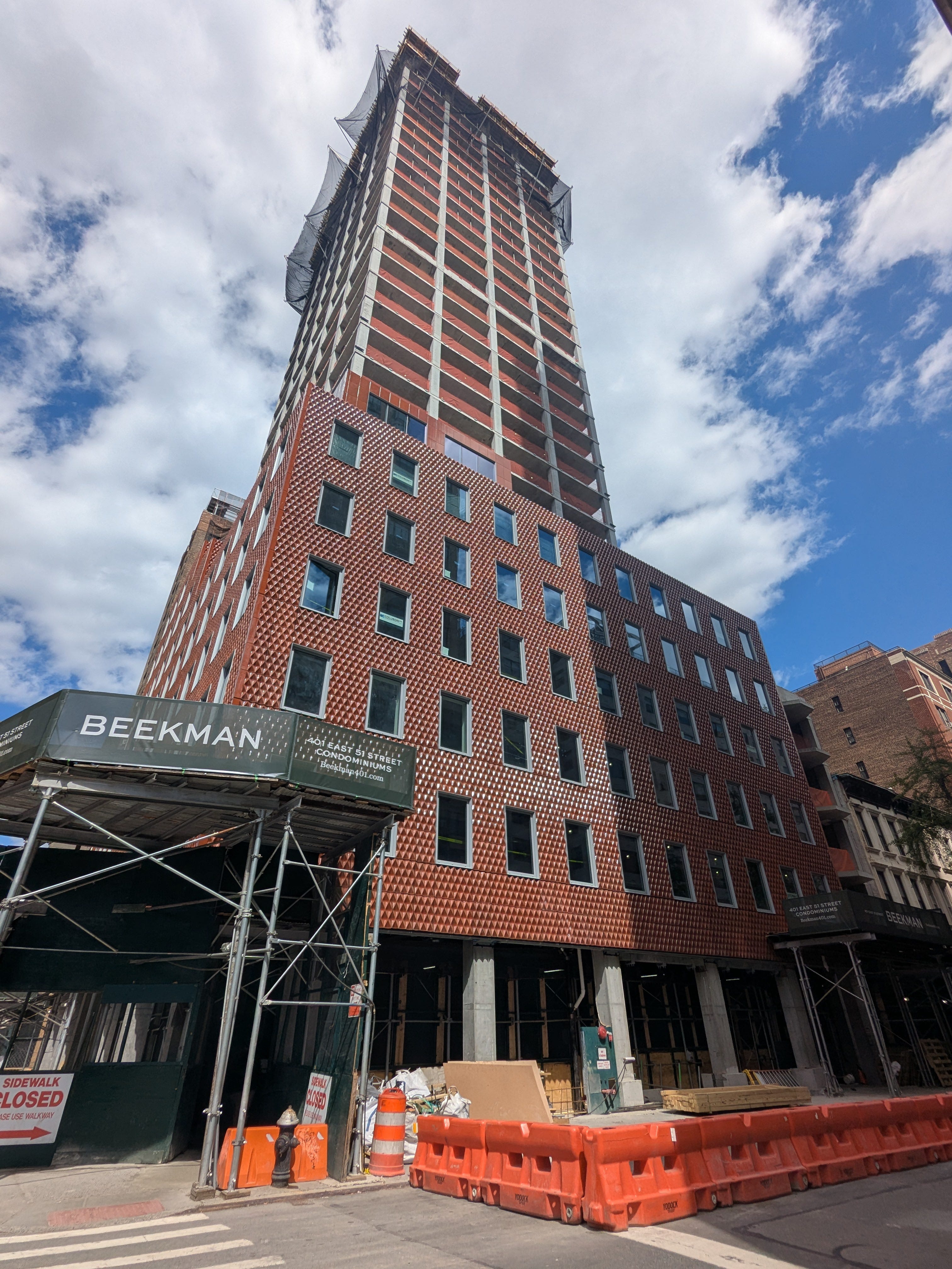
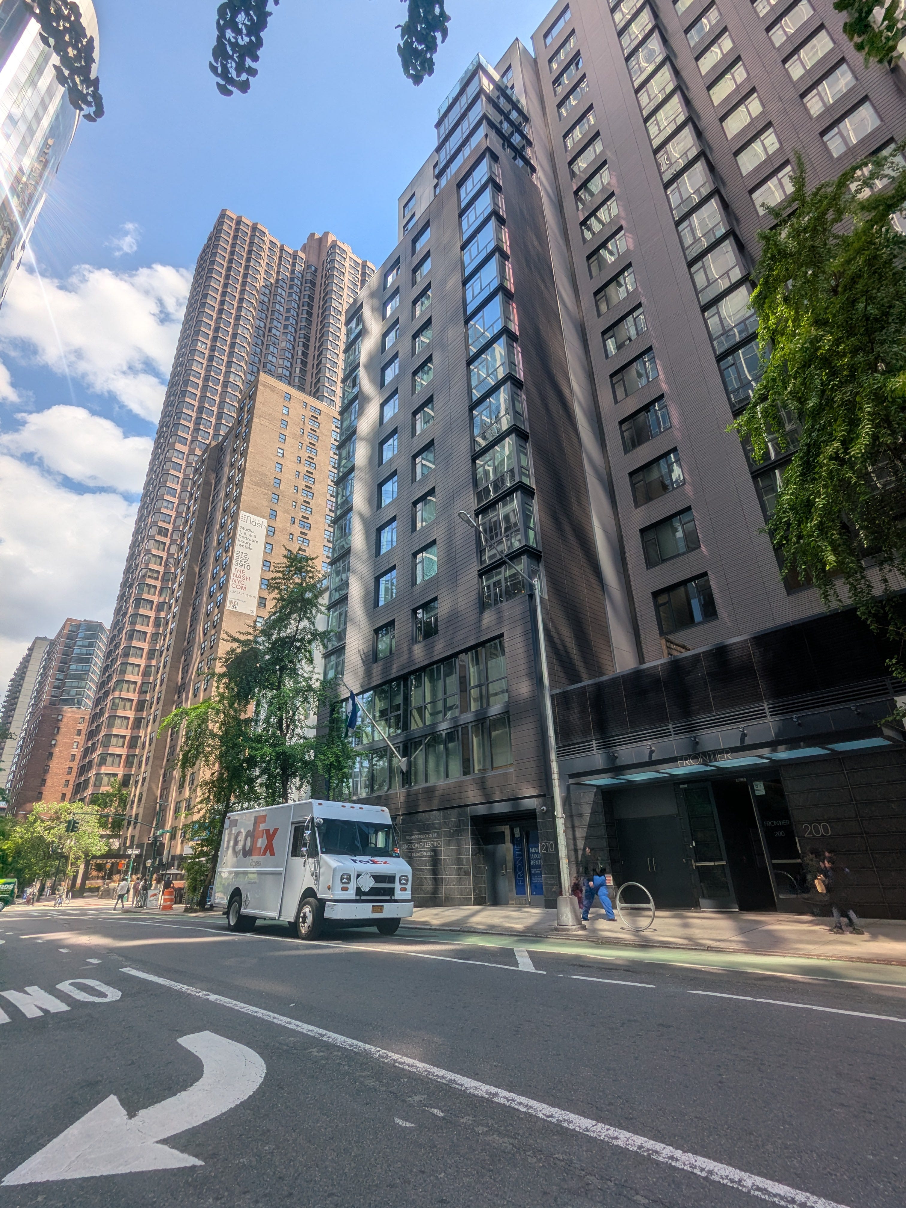
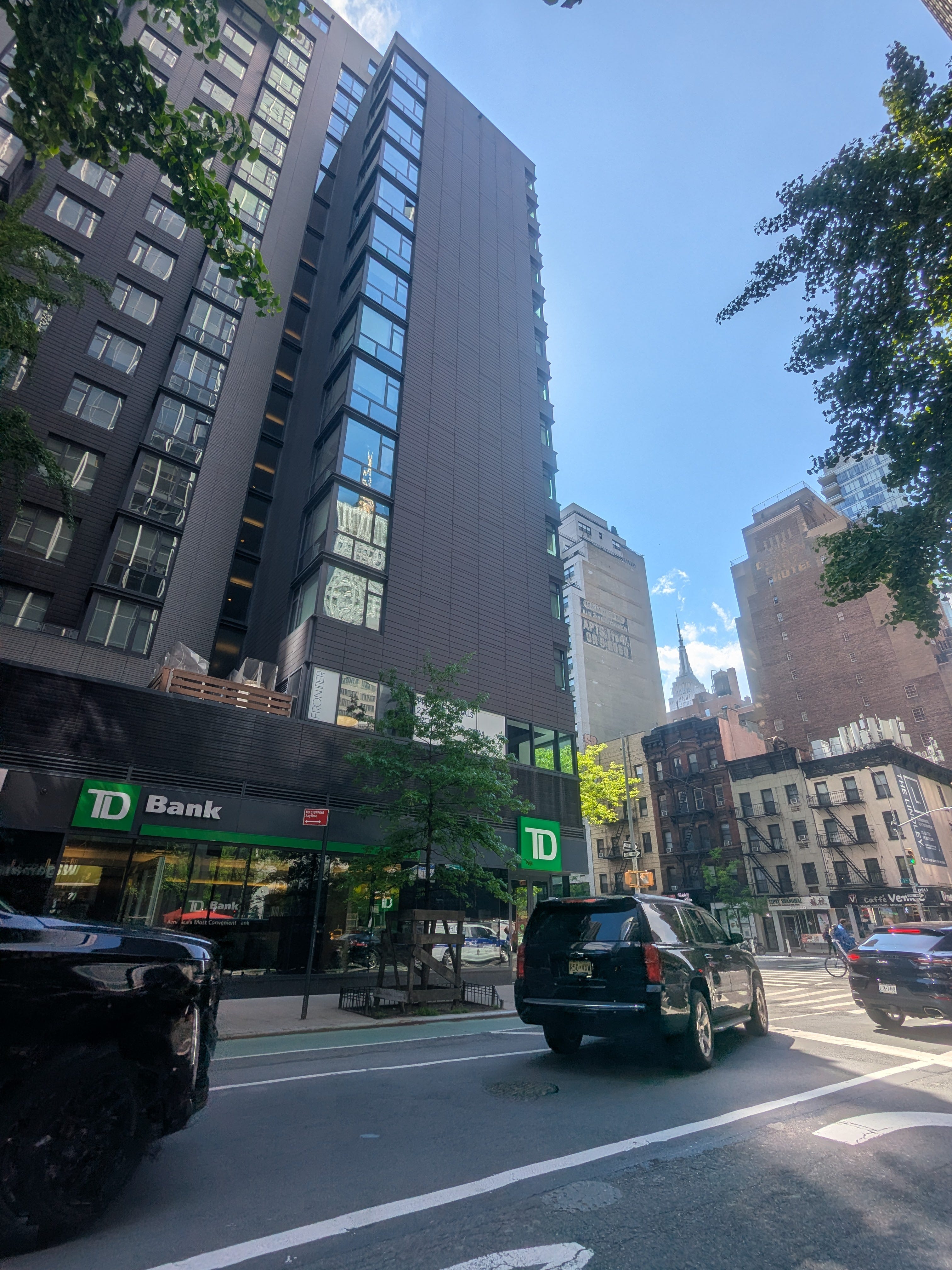
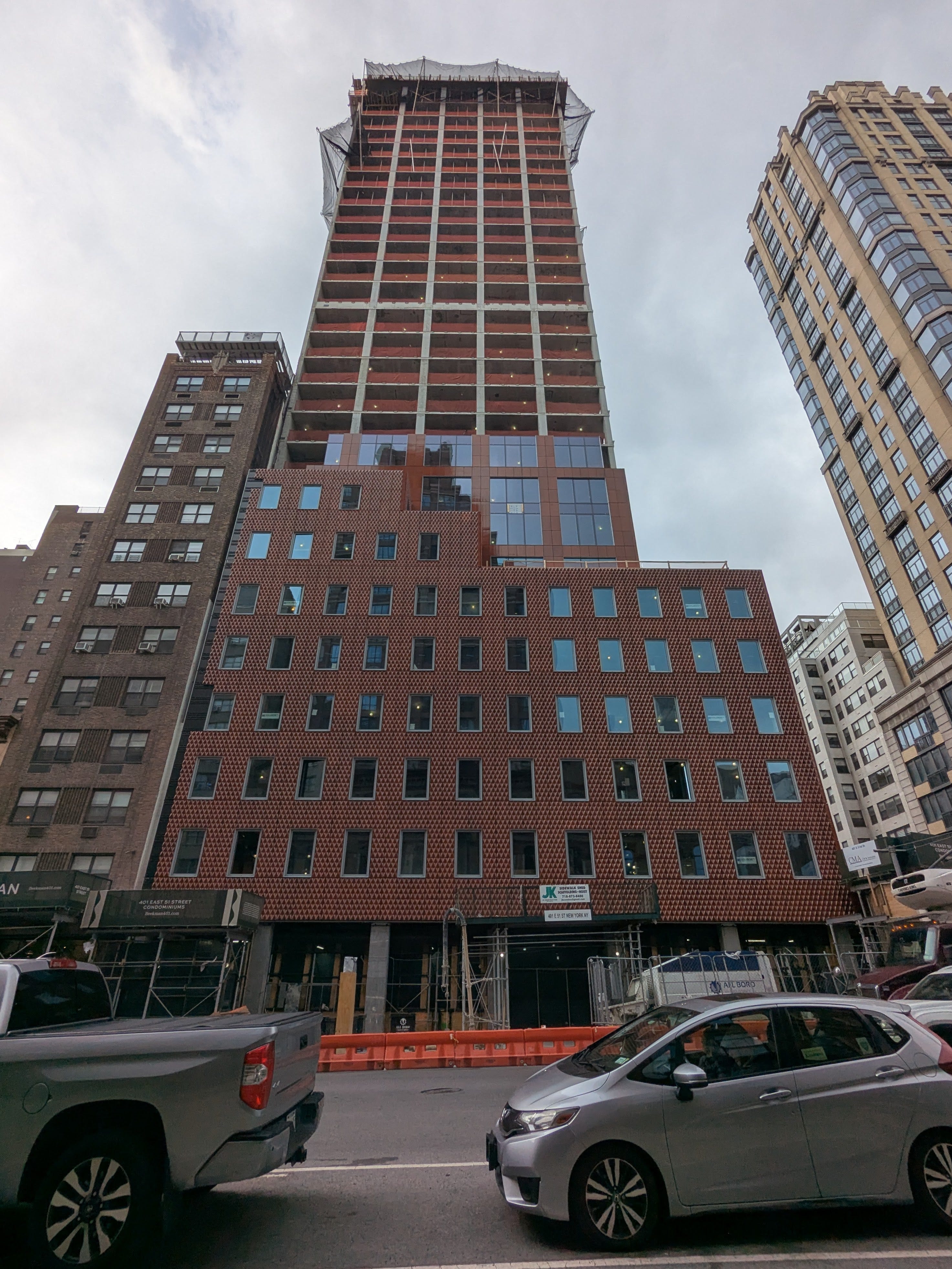
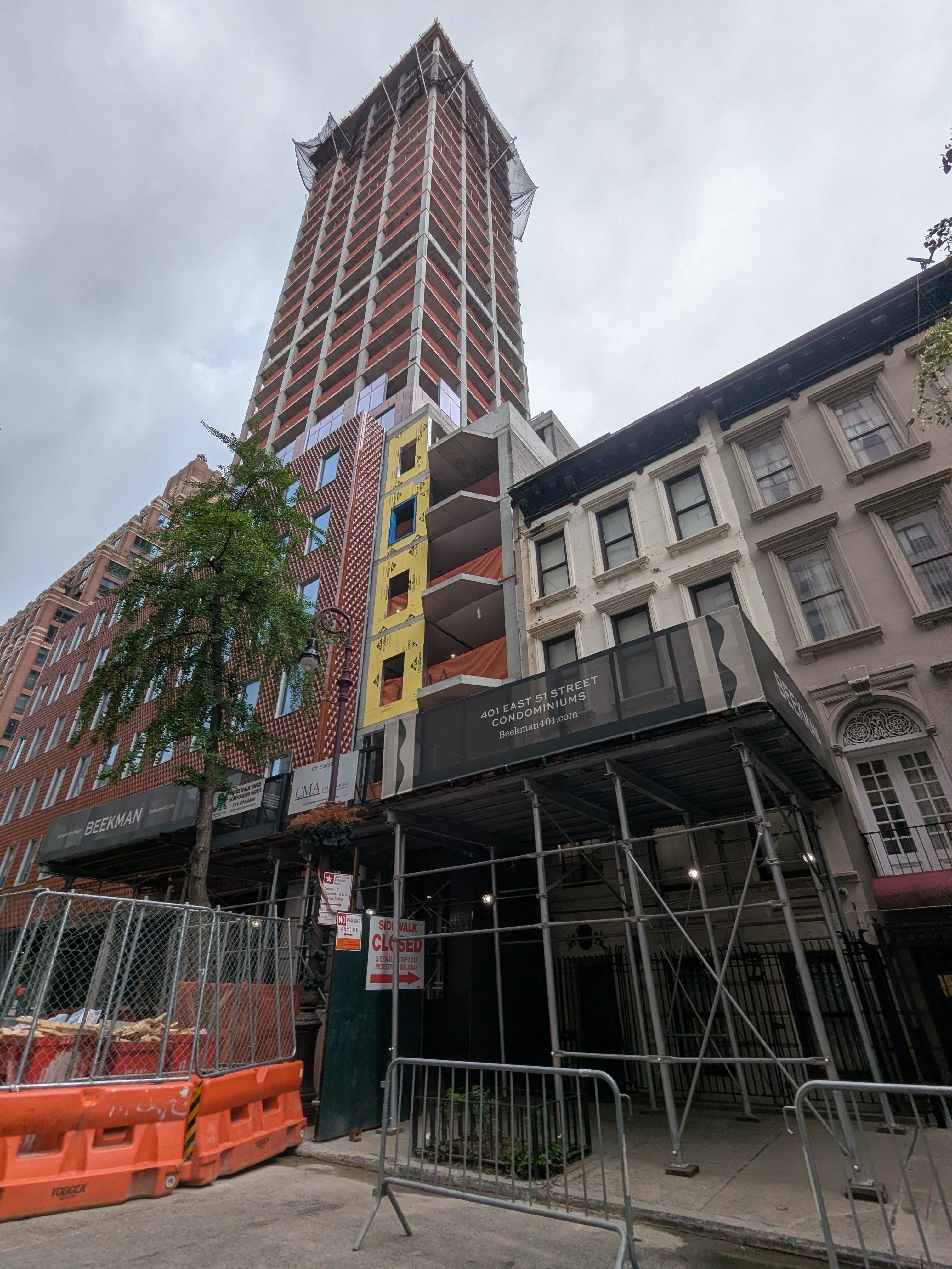
After an exciting Jane’s Walk earlier this month I found myself in Midtown East near the site of the Sutton Tower I recently wrote about, where I came across a 29-story tower going up on the corner of First Avenue and East 51st Street.
The terracotta cladding caught my eye first, but after a moment the shape is the noticeably stranger part. The first six or seven floors form a wide podium that fills most of the lot. Above that, the tower narrows substantially. I didn’t even notice it at the time, but if you look closely at the eastern edge of the construction site you can see the building stepping down to a much lower height at the rear of the lot. This is a pattern in NYC: when a new building has an unusual shape there’s a pretty good chance the explanation can be found in any number of zoning code adjustments made to that specific site over the years.
The site
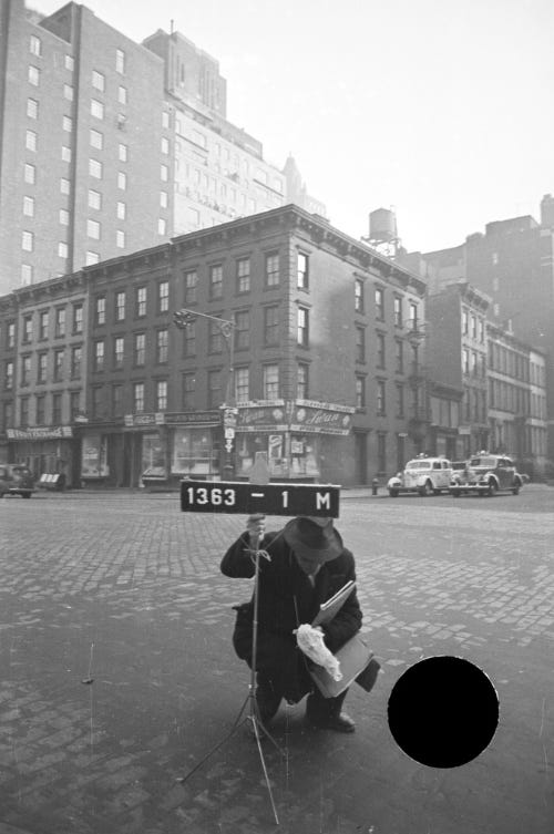
The 1940 tax photo shows what was here at the time. Four-story walkups on this corner. The 13-story Bing & Bing courtyard complex called Southgate is visible one block away. Same era, very different scale. Sometime in the next few decades they were replaced by slightly taller mixed-use buildings with a few more stories, but still leaving this corner of Turtle Bay pretty short.
But that squat status quo wouldn’t last forever. SK Development and CB Developers paid $46.8 million for the assemblage in June 2023 and $158 million in construction financing closed in February 2025. The new building, designed by Selldorf Architects with SLCE as executive architect, will have 83 condos plus three ground-floor retail spaces. Completion is anticipated in August 2027 and from my recent visit it does seem like quite a bit of work has already been done.
Three zoning compromises stacked on one corner
The first thing you’ll notice if you pull this parcel up onZoLa is that this small corner lot isn’t covered by only one zoning district. It’s covered by two: R10 along most of the lot, R8B on the eastern slice, with a C1-5 commercial overlay running along First Avenue. Some nearby properties have the same split, while other nearby lots escape the lower zoning designation entirely.
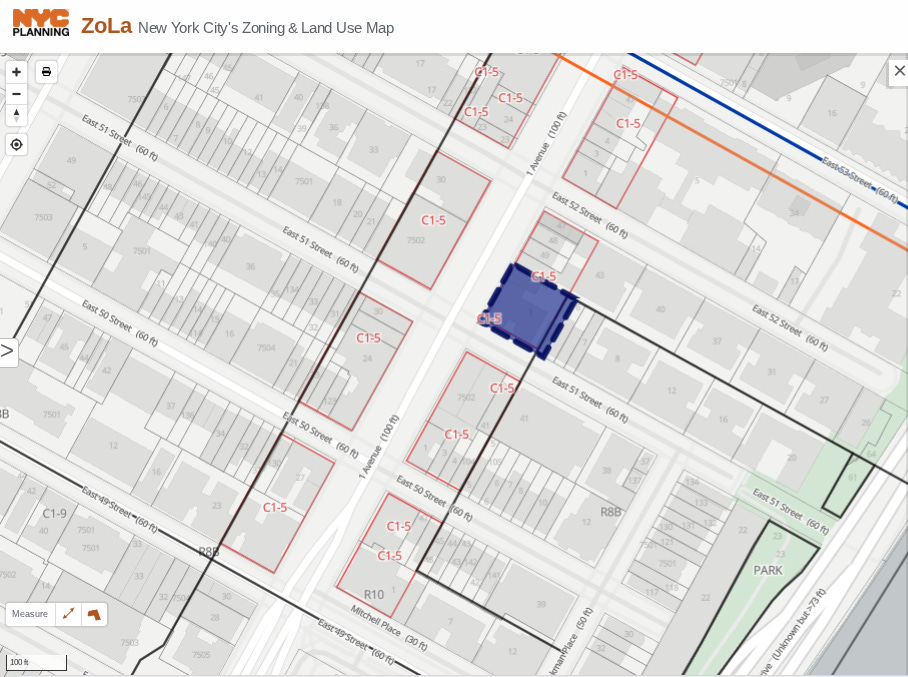
One might infer from the duplicative zoning that this corner has always had complicated restrictions on what could be built here, but the 1961 Zoning Resolution mapped the whole site R10 with C1-5. As I discussed in the Sutton Tower piece, 1961 wasn’t really a downzoning here. First Avenue already had tall avenue-frontage buildings from the 1920s, and R10 plus a commercial overlay was generous from the start.
The first downzoning came in 1986. Letty H. Simon and the Riverfront Fifties Association pushed the Board of Estimate to map R8B over the side-street area near Beekman Place. The trigger was a $43 million buyout offer for the Beekman Terrace co-op at 455 East 51st Street, which residents feared would lead to a teardown. The avenue itself stayed R10. The eastern slice of this parcel got R8B because the lot extends past the 100-foot avenue-zoning depth into the rezoned strip. Adjacent properties got different treatment depending on how far back into the block their lot lines reached. The line cuts arbitrarily through the block.
The second downzoning came in 2017, the result of the East River Fifties Alliance’s fight against the Sutton Tower. The Council outcome wasn’t a map change. It was a text amendment (ZR 23-675) that made tower-on-a-base massing mandatory for R10 districts east of First Avenue and north of East 51st Street. The amendment didn’t end up restricting Sutton Tower itself (which had already vested its foundation), but it did catch this lot, which sits at the southern edge of the affected area. This kind of bespoke restriction (a new design rule applied to one zoning category in one specific micro-area) is an example of how maddeningly complicated the New York City zoning code has gotten. Every time a neighborhood group wins a zoning fight, the code grows another permutation.
The form follows from these three layers: tower-on-a-base massing from 2017, 75-foot stepdown at the rear from 1986, all built within R10’s base 10.0 FAR from 1961.
How does this building have more density than the zoning allows?
There’s a fourth layer, less visible. Pull the project’s zoning diagram from DOB NOW and the residential FAR reads 11.68, not 10.0.
The answer is the old Voluntary Inclusionary Housing program (VIH). Under the rules in effect from 1987 through December 2024, R10 developers could exceed the 10.0 FAR cap by building affordable housing or by purchasing transferable Inclusionary Housing certificates from another affordable project in the same Community District. The bonus ratio was 3.5 square feet of market-rate floor area per square foot of affordable.
The certificate transfer was issued in two Completion Notices from HPD’s Office of Development on June 12, 2023,six months before SK closed on the 51st Street acquisition. 5,734 square feet of affordable floor area certificates moved into “51st Street Fee Owner LLC” from two donor projects: The Frontier at 200 East 39th Street (a 19-story rental with 91 units, 20 of them affordable at 60 percent AMI per6sqft), and a smaller rental at 210 East 39th Street (57 units, 11 affordable). Both are SK and CB rental projects, completed in 2015 and 2017 respectively. The 31 affordable apartments at those two buildings have housed lower-income tenants (studios from $833, two-bedrooms up to $1,381 per month) for nearly a decade. The certificates sat in the developer’s portfolio that whole time before being deployed at this site. The bonus translated to roughly 17,000 square feet of additional residential here, about four floors of usable program.

VIH had two features that made it work for this kind of project: certificates could be used anywhere within the same Community District (the entire CD6 here, from Murray Hill through Sutton Place), and there was no time pressure to use them. Affordable rentals could be built where the rental math penciled (40th and 39th Streets, adjacent to Grand Central), and the bonus could be deployed where the condo math penciled (Beekman, ten blocks north), a decade later. The two product types could each find their own footing.
How well VIH actually worked is hard to assess. Certificates are private property, traded between developers, with prices not publicly disclosed. HPD’s Inclusionary Housing Sites Map tracks where the affordable units exist but not where the bonus rights end up. A 2017 Manhattan Institute report estimated 2,888 VIH units had been built or approved through July 2013, the program’s first 26 years. Implementation depends on multi-step certificate transfers like the one at this site, which aren’t easy for the public or even the city to audit. The opacity is part of why VIH was controversial.
What City of Yes changed
City of Yes for Housing Opportunity, adopted by the Council in December 2024, was generally aimed at moderately-dense neighborhoods where existing zoning was constraining housing supply (much of the outer boroughs, low-density Brooklyn and Queens, parts of the Bronx). The reform replaced VIH with the new Universal Affordability Preference (UAP), available citywide in R6 through R10 districts. That citywide expansion is a real win for places where dense housing wasn’t previously allowed.
But for already-permissive pockets like Midtown East, the change made certain projects harder. UAP’s terms are structurally worse than VIH for high-end Manhattan condos:
The bonus ratio fell from 3.5:1 to 1:1. The same 17,000 square feet of bonus floor area now requires 17,000 square feet of affordable production instead of 5,734.
Required affordability is more demanding. UAP requires an average of 60 percent of Area Median Income; VIH allowed averages up to 80 percent. The deeper affordability is good for tenants and harder for developers to absorb in a luxury condo building.
Geographic flexibility was reduced. VIH allowed offsite affordable anywhere in the same Community District (the same CD6 that includes both 39th Street and 51st Street here). UAP’s offsite option is limited to former Inclusionary Housing Designated Areas and former R10 districts, sunsets in 10 years, and no new certificates can be created.
This was not a hidden side effect. Industry voices warned about exactly this outcome during the July 2024 City Planning hearings. REBNY testified that scrapping the offsite option created “a significant risk that developers will simply choose to build within the existing zoning limits and not try for a bonus” (per Crain’s coverage). Manhattan Borough President Mark Levine wrote in his official recommendation that condo projects in Manhattan have “often necessitated using the off-site provision option for project feasibility.” CHPC, the Citizens Housing and Planning Council, proposed adding a permanent offsite option to UAP specifically to preserve flexibility in expensive neighborhoods. The administration kept the offsite option only in former R10 and IHDA areas, with the 10-year sunset.
So the criticism was made, the tradeoffs were identified, and the Council adopted the reform anyway. The bet was that the broader UAP eligibility (citywide R6 through R10) produces more affordable housing in aggregate than the targeted VIH it replaced, even if specific Manhattan condo projects get harder. We won’t know for a few years.
What gets built when nothing organized opposes it
Standing at the corner now, the building reads as a competent piece of work. The Selldorf-designed terracotta facade is unusually nice for a by-right Manhattan condo. SK chose to build 12 enclosed parking spaces on a site where they could have built up to 16. Zero was also an option (no parking is required in the Manhattan Core, and hasn’t been since 1982).Even at high Manhattan condo prices, the developer’s signal is that not every unit needs a parking space.
If you know how to read it, the form of this building is the zoning code visible from the sidewalk. The 75-foot stepdown at the eastern rear is 1986. The wide podium with the slimmer tower above is 2017. The four extra floors at the top are VIH (a program that no longer exists). The bird-friendly glass on the lower floors is Local Law 15 of 2020. The green roof is Local Law 92/94 of 2019. Every floor is a regulation, and every regulation came from a different fight over a different decade.
A lot of people are going to look at this building and think it's ugly, or too gangly, or out of scale, or all three. But this is exactly the building that decades of land use planning in this corridor called for. By-right zoning absorbed all of it without a public hearing, a community board vote, or a single ULURP application, because nothing required public approval. The 401 East 51st permit came from a clerk at DOB NOW. The architect's diagram showed compliance, and the city issued the permit. Forty years of compromise produced this building. By-right zoning absorbed every layer of it without a public hearing. And the rules have already changed again. The next building like this might not be possible.